The Rio Napo (river) in Ecuador is one of the best river journeys available in S. America and I had the opportunity to venture into the Amazonian basin down the Rio Napo, which is a hugely vast region comprising of mostly Brazil but also containing significant parts of Ecuador, Peru, Bolivia, Colombia, Venezuela, and other countries along the northern coast of the South American continent.

Note - Click on any image including the above and the light-box viewer will display a much larger view.

Note - Click on any image including the above and the light-box viewer will display a much larger view.
As the rains fall in the high mountain regions of these countries, these waters find their way down the elevations as streams turning to rivers then flowing into the Amazonian basin itself.
Within this vast area are a few central and main rivers which feed into the Amazon River proper and these waters eventually continue their path down the lower elevations through Brazil into the Amazon River delta area at the Brazilian coast on the Atlantic Ocean .
In Ecuador these main rivers are called the Rio Napo and Rio Pastaza. In Peru there are two main rivers, one being the Rio Yucayali and Rio Huallaga with smaller rivers as well.
I am going to focus on the Rio Napo in Ecuador since this is the topic point of this writing (See Map). The map also contains more data points for river travel in Peru and Brazil.
From the oilfield city of Coca or its proper name of Puerto Francisco de Oreallena in Ecuador which is a very dirty and unremarkable city, the river flows toward the Peruvian border with the last village being Nuevo Rocafuerte before the Ecuadorian/Peruvian border and this length is some 240 kilometers long. By motorized longboat or “canoe” it takes 12-14 hours to make this transit which is going with the down stream flow of the river and I judged the flow of the river current at around 2-3 knots. There is one and only one stop along the way for food, drinks and leg stretching. To return upriver it takes about the same amount of time however the longboat is fighting the river current and I was told that it takes about 80 gallons of petrol for a down river run and 100+ gallons of petrol for the up river run. These boats use two 50 hp outboard motors.
Tickets for the trip from Coca to Rocafuerte can be purchased from three different companies. The first company is Cooperative of Francisco de Oreallena and these boats are not luxury and carry cargo. The next company is Cooperative Kamu Kamu. For more information, click here and you will go to the web site that has contact numbers, address and departing times. Just remember, all things are subject to change but in most cases with these companies, this data seems to be recent. Lastly, there is a ecotourism company called Agurico Municipality which runs more luxury boats and comfortable seats and information for this company will be found on the same web page as above.
The river itself is for the most part very wide but there are areas where it does choke down but not by a great amount. Also, during the dry season the river is very shallow in a lot of places, huge sandbars are exposed, the depth can be less than 4 feet and there are always trees buried deep in the sand and river bottom which makes navigation of the river challenging at best.
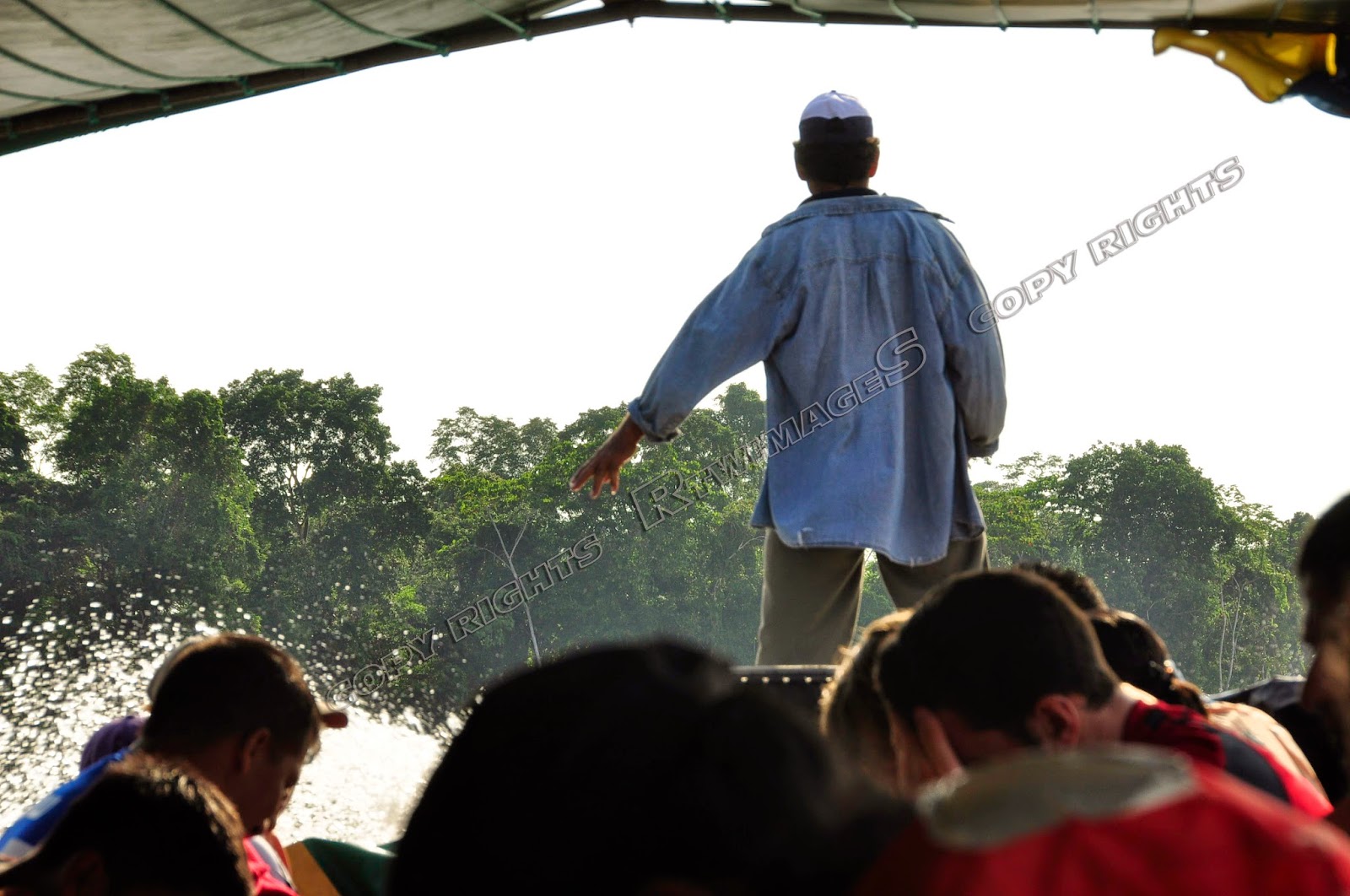 |
| Navigator |

The longboats leave the city of Coca on a rather fixed schedule of days and times. For down river journeys to the village of Nuevo Rocofeurete
For the up river journey to Coca it departs in the darkness around 4:30-5am and it basically runs the same days but departs the Ecuadorian border.
 |
| On River In Early Morning Fog |
The place to acquire a ticket in Coca is located along the river at the jetty office not too far from the city center and it is close to the Hotel Safari which provides basic accommodations and is a good place to stay because of its close proximity to the pier where the boat departs.
However, this is not about the boats or Coca but instead, about the life on the river itself as observed during my time there, as well as about an adventure experience into on region of the world very few travelers will make. This is also about a journey into one of the few remaining primary rain forests that has had little exploitation or development but it is coming
First we must understand the type of climate. It is lowland tropical, very humid and almost always rainy even in the dry season. As the sun rises each day the moisture in the rivers and wet areas begins to evaporate during the day and rises until it forms clouds heavily laden with moisture. This process continues until these clouds can hold back no longer then it will rain. This cycle of rain, heat, evaporation, cloud formation and finally rain is constant and never ending so the peoples that live in this region and climate must adapt their lives around this climate.
This not only means that the clothing they wear must accommodate this climate but the climate also dictates how the buildings and homes are constructed all of which must withstand and tolerate this climatic onslaught of heat, humidity and rains.

Living along a river such as the Rio Napo or any other river in the Amazonian basin is a life of continual efforts to survive, fighting with the effects of the tropical climate which tends to eat at everything possible. The homes of the locals who live in this region are interspersed along the river on both sides. Sometimes the water level is very low other times extremely high.
 Because the river can rise quickly after a rain storm and has such tremendous force during the heavy rain periods with extremely strong currents, it is impossible to construct any sort of landing or dock on the river bank as it will be swept away with the first high water event. Therefore, no one has a dock but instead just the river bank with maybe a set of steps carved out of a tree and leaned against the bank itself from the lowest point to the upper level where the home is located.


There is generally no electricity with the exception of larger communities, and villages and even these have electricity on a limited basis.
Laundry is done along the river side by the women and children whose task it is to clean the clothing on a daily basis. This is accomplished with a scrub brush and a bar of soap made for laundry purposes. As one travels up or down the river you notice the women and children scrubbing, rinsing, scrubbing, pounding and rinsing each article of clothing then tossing it into a basket. Of course drying clothing in this environment is a very slow process and there is usually one area of the house where the clothing is hung on a line, inside yet out of the rain. If the sun does not come out it can take days for the clothing to dry fully if it truly does dry.
As the longboat travels along the river you observe the children out on the banks playing as any other child would play. The boys tease the girls, the older children take care of watching the younger children, the school children make fun of each other and life here is very simple. Children leaping from the trees into the river, others swimming along the river bank in the current and usually there is no parent close at hand; these children are raised in this environment and taught the hazards of their play and the river itself. Also as the longboat travels up the river the children are seen running along the bank after the boat. For the people to stop the boats they must use a torch (flashlight) in the darkness or wave a white piece of cloth so the driver or navigator will see them.

To say that life on the river is slow and laid back would be an understatement. It is hot and humid so very few are in too much of a rush to accomplish their tasks. The children go to school in the early morning hours then leave by mid morning for home where they will work or play.
The pace of work is also slow. People here accomplish as much in the early hours of the day as possible. As the sun begins to heat the environment the clouds begin to build up and usually by the late afternoon the rain will begin then stop leaving an extremely humid and still environment in which to work. This rain pattern will be interrupted by short periods of sunshine then more clouds, the temps drop a bit the rain starts again and the entire process is repeated.
In the small village(s) where there is power you can walk down the few streets which are lined with a few buildings some being restaurants others are the equivalent of the general store where the shop owner has a supply of goods from foods, drinks, dvd’s, clothing, shoes, medical supplies and everything else you can think of.
There is almost no industry as such and I only found one small place where rice was being processed in very small quantities, other than that, this region is basically subsistence living with the odd travel into the larger city for more supplies.
The region of the river where the Ecuadorian & Peruvian borders meet has one main national park known as TheYasuni which is contained on the north and on the south side of the river. It is accessible only by boat via a river ride off the main river the Rio Napo.
The Yasuni area is one of the most biologically diverse areas on the planet and one of the few remaining primary rain forests to be protected from timber and oil/gas extraction. An initiative was announced by the Ecuadorian government to protect this area but this initiative has failed. Click here to read about this initiative, its stated goals and the reasons for its failure.
One of the main reasons for making this very long trip will be to head into the Yasuni from the village of Nuevo Rocofeurete. It is easily accomplished but might take a bit of Spanish language skills to work out the details but I found that it was not a problem to arrange with some effort. I can not quote prices as they will be determined by the type of arrangements you make with the boat driver such as length of time, where you go and other factors.
You will take a small covered metal boat with outboard engine down the Rio Napo for some distance and depending on what arrangements you made, you will then turn into the Yasuni, either going north or south. From there the boat driver will take you down smaller rivers into the park itself. He will stop for you to swim and will also either have some fish or will catch some fish for bait to eventually be used in fishing for Piranha.

You will see if you are observant different species of birds, some more common and some more difficult to see. I suggest that you tell the boat driver to go slow when going though the mangrove areas as the more exotic birds will be seen there.
The following images are also from within the Yasuni region. There is so much more to see and I can not add too many images or you will never go to see this wonder of nature for yourself.


From the Ecuadorian border it is possible to continue down river into either Peru or Brazil on the Amazon River proper. These river journeys are long, hard, lacking comforts but can be some of the most rewarding of adventure travels anyone could experience. (See Map)
One of the main reasons for making this very long trip will be to head into the Yasuni from the village of Nuevo Rocofeurete. It is easily accomplished but might take a bit of Spanish language skills to work out the details but I found that it was not a problem to arrange with some effort. I can not quote prices as they will be determined by the type of arrangements you make with the boat driver such as length of time, where you go and other factors.
 |
| Piranha Fish |

You will see if you are observant different species of birds, some more common and some more difficult to see. I suggest that you tell the boat driver to go slow when going though the mangrove areas as the more exotic birds will be seen there.
The following images are also from within the Yasuni region. There is so much more to see and I can not add too many images or you will never go to see this wonder of nature for yourself.


If you have the time and desire to see a remaining area of the world that still is basically untouched, then I would hope that you take the opportunity to go down the Rio Napo in Ecuador and into the Yasuni National park areas before they are slash cut for either timber or roads to access new oil reserves. At the time I was there it was still pristine but this will not last forever.
So, step out there and take a journey that you will remember the rest of you life.
Travel Safe, Travel Happy
So, step out there and take a journey that you will remember the rest of you life.
Travel Safe, Travel Happy